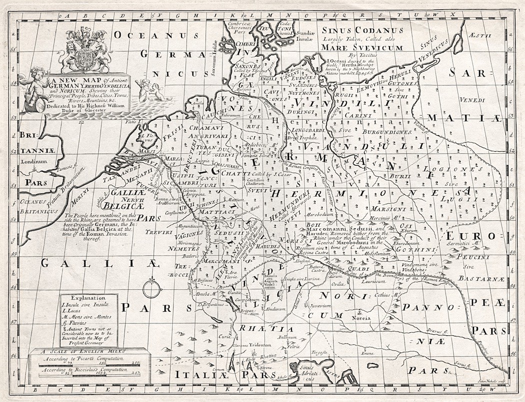
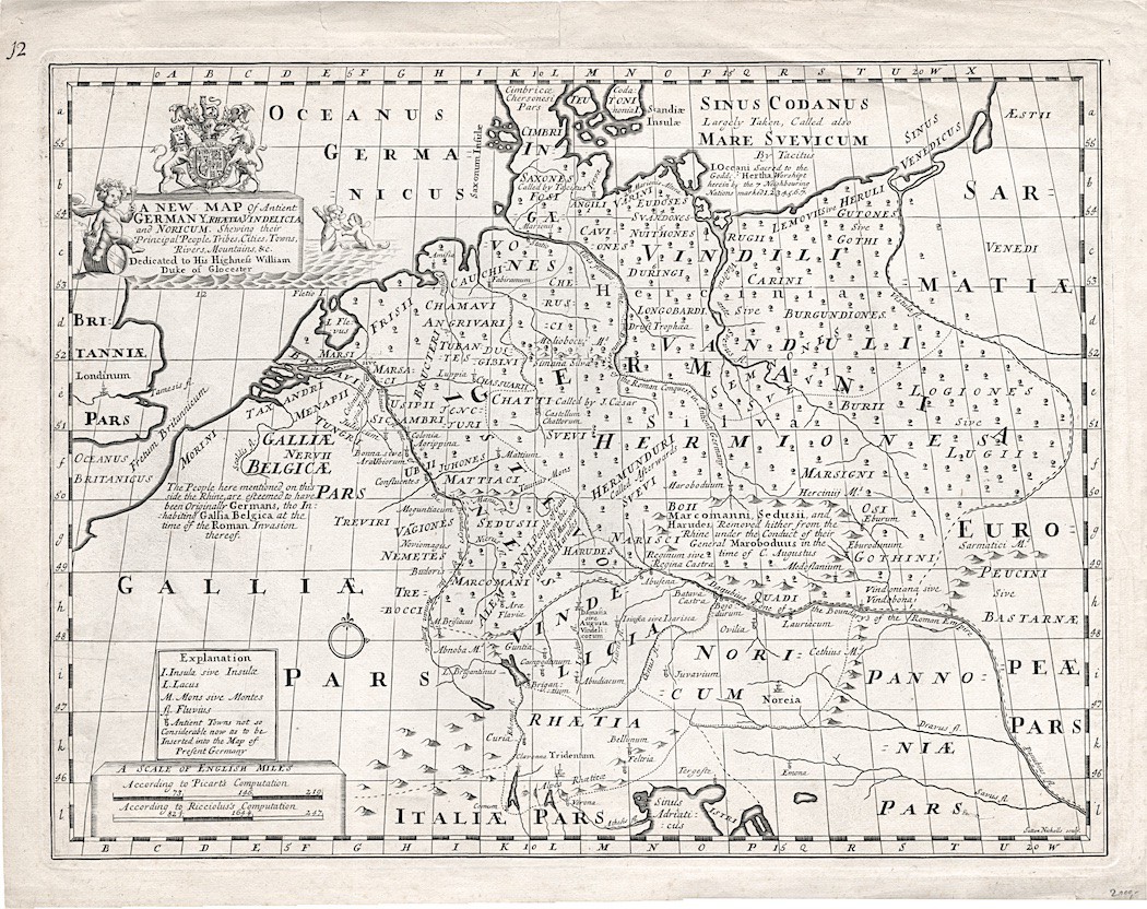
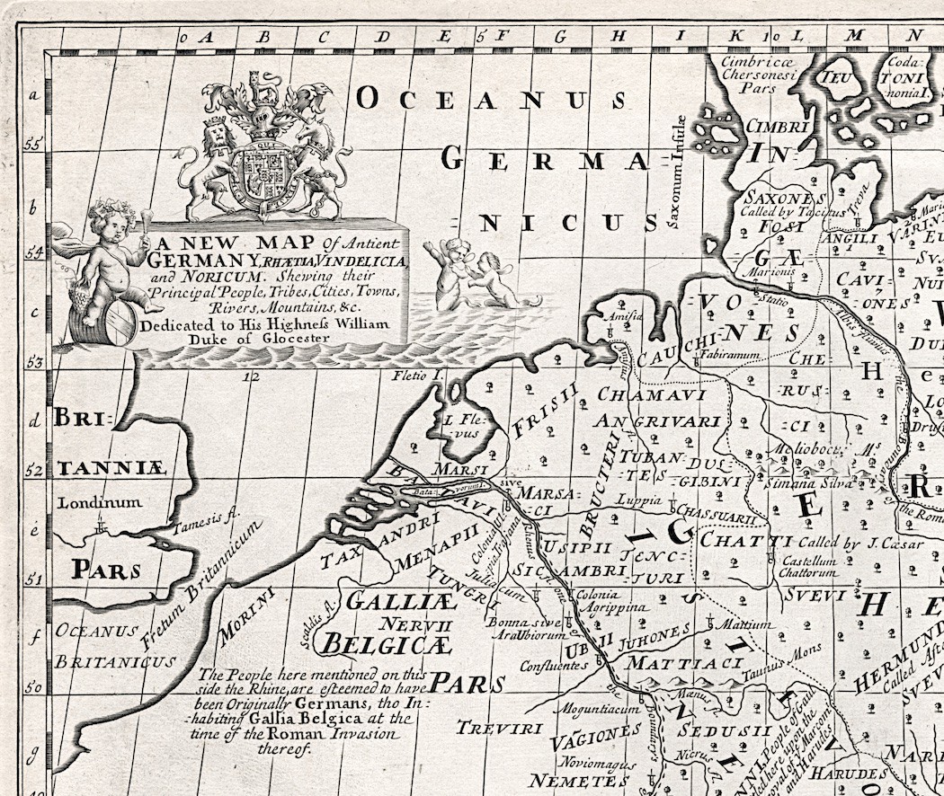
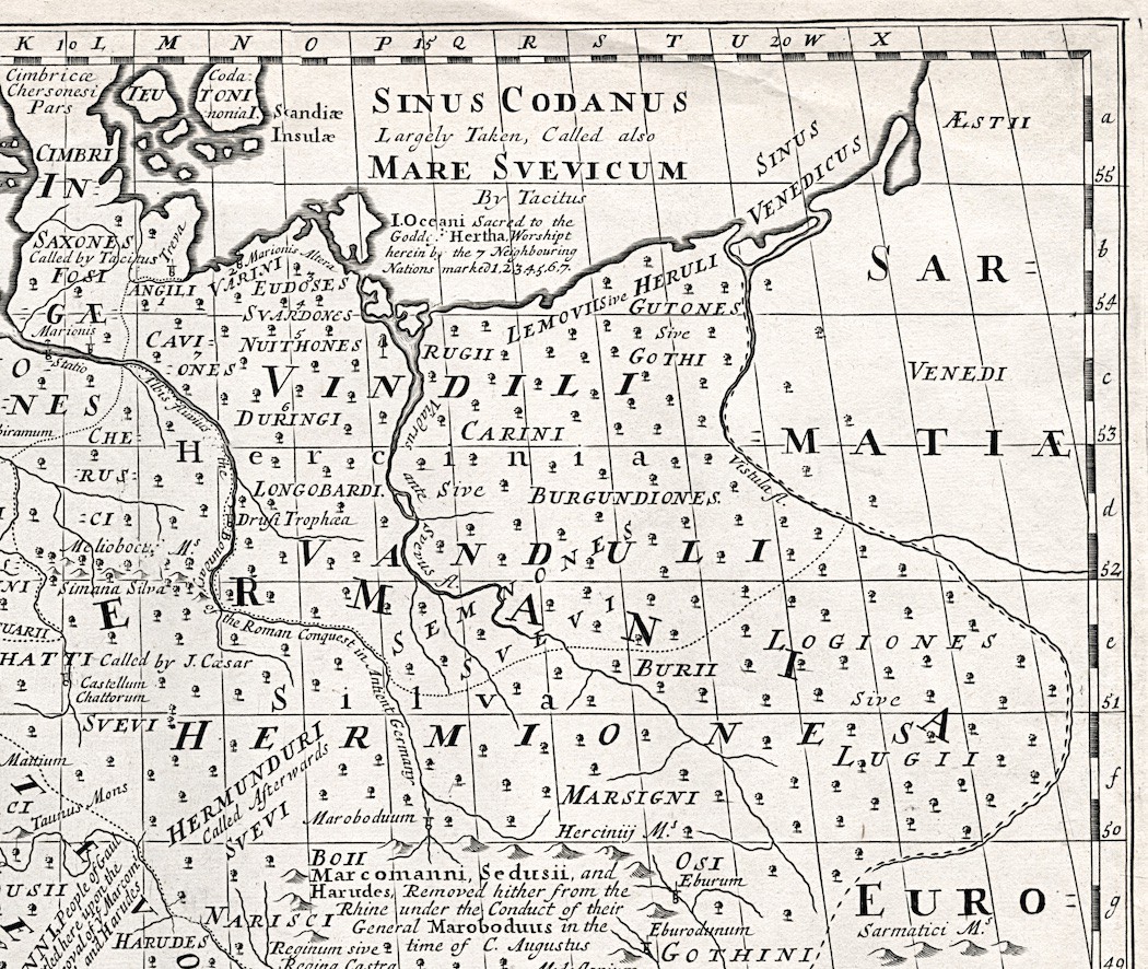
Germany, Wells, mědiryt, (1720)
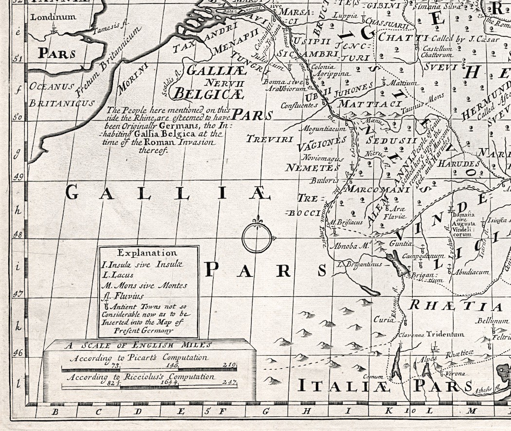
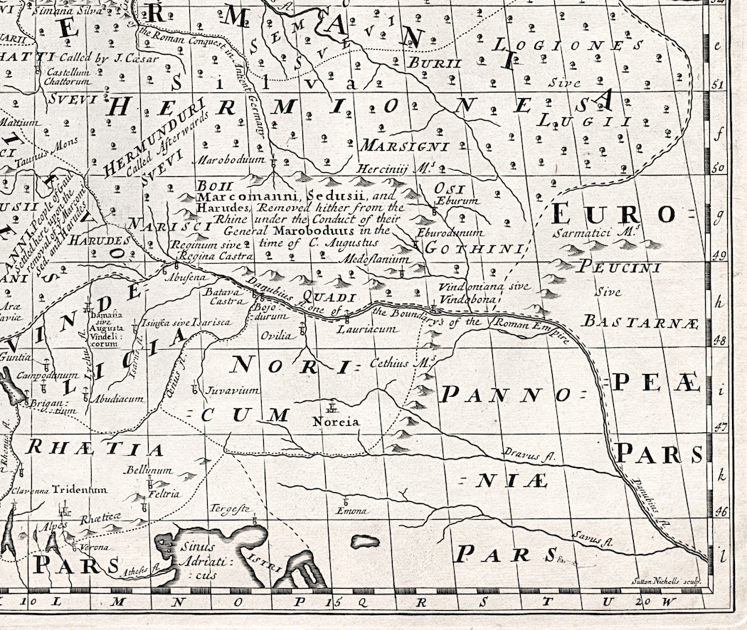
- A New Map Of Antient Germany, Rhætia, Vindelicia, and Noricum. Shewing their Principal People, Tribes, Cities, Towns, Rivers, Mountains, &c.
- technika: mědiryt
- rytec: NICHOLLS, Sutton
- rozměr tiskové plochy: 48 x 35
- rozměr listu: 52 x 41
- z díla: A new sett of maps both of antient and present geography. 13.
- vydal: WELLS, Edward, Oxford,(1720)
")